In Crossing the Driftless: A Canoe Trip through a Midwestern Landscape (2015), author and long-time paddler Lynne Diebel recounts a 359-mile trip by canoe and portage that she and her husband made in 2009 from Faribault, Minn., to Stoughton, Wis. Diebel grew up in southern Minnesota and lives in Stoughton. Her book is excerpted below.
Adrift in the Heart of Wisconsin’s Driftless
A 359-mile canoe trip through the upper Midwest.


June the thirtieth. At dawn, the cold heavy fog and its accompanying sense of mystery drench the river. Alive with the possibilities of the day, we slide our canoe into the current downstream of Lock & Dam 6. We know that by afternoon boredom will have set in and all the trees will look alike, but for now the river runs through our veins. Once again, we’re the only boat on the river, yet we are not alone. Herons and egrets fish the shallows and eagles soar above. The eyes of a big snapping turtle watch us, disappearing swiftly and silently as we get too close.
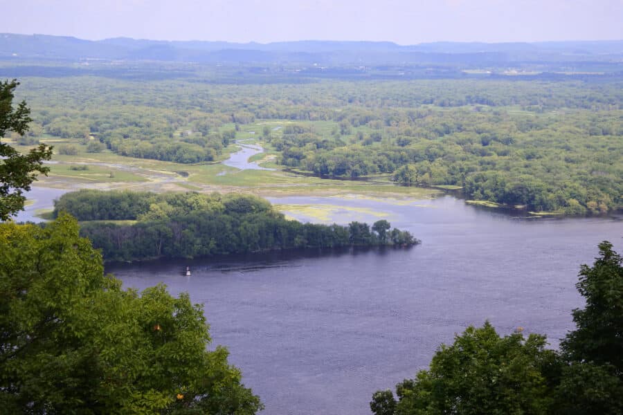
We follow the channel and the channel follows the Minnesota shore, where a stately line of half-dome bluffs rises over 500 feet above the river, a precipitously steep wooded array of cliffs, faced in places with rocky outcrops of St. Peter sandstone or of the Prairie du Chien Formation, the rocky layers of ancient seabed that built these bluffs. Across the Mississippi in Wisconsin, the top of a ghostly pointed bluff, twin brother to Trempealeau Mountain, appears to float on the surface of the low-lying mist. We’re in the embrace of the bluffs now and I feel the visual power of this familiar landscape in a way that only happens for me on the river. Viewing the river valley from acreage or an overlook is a snapshot, a static moment. Floating the river is a movie. It’s a subtle but telling difference. As we travel down this wide, deep valley, the ebb and flow of shape and form, the ever-evolving view, slide past my eyes in a visual narrative, and the grandeur of the Upper Mississippi builds. I find a kindred sense in the accounts of early explorers, who at first believed the lines of bluffs were mountain ranges, and in the many accounts of writers who followed. In Letters and Notes, George Catlin wrote, “From day to day, the eye is riveted in listless, tireless admiration, upon the thousand bluffs which tower in majesty above the river on either side, and alternate as the river bends, into countless fascinating forms.”
The paddler finds that the morning fog shapes a different image than does the late afternoon sun. On every passage down the river, the angle of the light, the hues and textures of water and land change. When Catlin painted the familiar forms of the Mississippi bluffs, many were treeless; today, after centuries of wildfire suppression, most are thickly forested. I recall historic accounts and art as we float, and the images blur into one. We’re traveling down a river valley peopled by the ghosts of paddlers past.
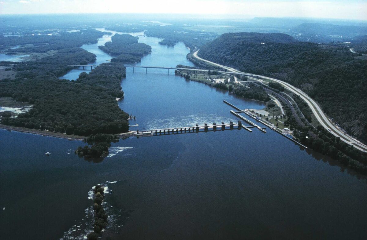
But the river is quite real, and very soon, it seems, Pool 7 comes to an end. As we pass Dresbach Island, both the speedboat traffic and our ever-present tailwind begin to rise. A fight ensues between the wakes and the waves and we’re caught in the middle of the muddle. We paddle cautiously into Lock & Dam 7 through water that our paddling friend Warren would call “squirrely,” a chaos of current, cross-chopped waves, and boat wakes bouncing off the concrete walls that guide the river craft into the lock’s inner sanctum.
From within, I look downstream, over top of the lock gates, all the way to the bridge that carries Interstate 90, the bridge I have crossed so many times in my life. I’m about to see it from underneath for the first time. Already I sensed how disconnected the bridge is from the river, how foreign its linear shape and concrete materials are in this curvaceous riverine world. When we crossed the same bridge in our car, concrete sidewalls prevent us from looking down to the river that flows directly below us; only distant water is visible.
My perfect bridge is one built of wood or stone, with see-through railings that afford a clear view of the river, a tacit acknowledgment that the river should be seen, has beauty and importance. A bridge with solid sidewalls one cannot see through is a statement that what lies below is not worth looking at, that all that matters is crossing the river. In the same way, locking through forces us to encounter the river as a human construct rather than a natural flow of water over land.
Beyond the bridge, a glimpse of a distant cluster of moored houseboats—a house on the water has definite allure—alongside scattered sandbar encampments—even better—returns me to an intimate relationship with the river. We’re at the upstream end of the long river town of La Crosse and also at the upstream end of an elaborate riverine highway interchange. The Black and the La Crosse both flow into the Mississippi from Wisconsin at this sprawling confluence, and the Root River joins the Mississippi from Minnesota at the downstream end of town. …

When the Corps impounded the Mississippi in the 1930s, the final reach of the Black’s main channel, which runs parallel to the Mississippi for about ten miles, disappeared under the waves of Lake Onalaska, the wide shallow expanse of open water behind Lock & Dam 7, separated from the main channel of the Mississippi by a string of low wooded islands. Within the lake, the Black’s now amorphous main channel hugs the shoreline, forming again when it slides between the shore and French Island. Downstream of an earthen dam and concrete spillway between the island and Onalaska, and downstream of Lock & Dam 7 and the interstate bridge, the Black reaches its historic and true confluence with the Mississippi, slyly subverting the lock.
Here on the river I feel as though I’m starting to understand this complex confluence, at least a little. These recent chapters in the story of the Black River’s relationship with the Mississippi are on record, but I wonder too what permutations the Black went through before written history. Some clues lie upstream. When Bob and I first canoed the Black, it was between the towns of Irving and North Bend, a particularly lovely and remote stretch of river that rambles through the steep hills of the Driftless. The wide gorge, sandy bottom, and frequent sandbars along this reach reflect the lower Black’s ancient past as an early outlet for Glacial Lake Wisconsin, and the dark water for which the river was named comes from organic compounds at its headwaters in northeastern Taylor County, a little way south of Timm’s Hill, outside the Driftless. After the river crosses into the Driftless at the city of Black River Falls, it traverses the unglaciated area from northeast to southwest. The river valley, carved into the ancient bedrock, grows deeper as it nears the Mississippi River valley, and the underlying geology of the Driftless is visible along this reach. We walked into the mouth of one of its tributaries, Roaring Creek, a small stream with a steep gradient, and up the narrow sandstone canyon that flanks its final drop into the Black, to see a series of small waterfalls drop over sharp-edged hard bedrock ledges. On one tall bluff we paddled next to, the moist Cambrian sandstone bedrock of the sheer cliff face was covered with the small leathery leaves of liverwort plants, anchored by their rhizoids in rock fractures, doing their part to disintegrate this rock face: a very long-term project, and one tiny piece of the Driftless Area’s master plan to erode the Paleozoic bedrock. White pine tops the bluffs and the lower banks are densely wooded with hardwood trees and river birch. Because little of the Black’s watershed is agricultural and much is forested, phosphorus and other nutrient levels are low compared to the nearby Trempealeau and the water is clear. In the shallows, we spotted live mussels and their tracks in the sand. In deeper water were northern pike, bass, redhorse and huge schools of minnows. And the many bald eagles that flew over us are further testament to the river’s abundant fishery. That day the river was low, only about a third of its usual flow, and we had to follow quite a meandering downriver course, occasionally grounding in the shallows and wading for a bit. The channel split at one point; searching for higher water, we wandered off into an alternate Black River, a channel with more flow and fewer deadfalls.
To the paddler, Driftless rivers seem to be all about change. Water levels rise and fall, sometimes dramatically. When the river floods, whole trees are scoured from the banks and carried downstream to be dumped carelessly on sandbars or in sandy shallows, where their presence helps shape the ever-shifting sandy outlines of the channel. The Black shares its past with the Wisconsin River—both drained Glacial Lake Wisconsin and both were log transport routes from lumber camps to the Mississippi during the logging of the north woods. Though the Black is a smaller river, in the eyes of the paddler they look very similar, as do their sandbars, ever moving and shifting.
From The Driftless Reader edited by Curt Meine and Keefe Keeley. Reprinted by permission of the University of Wisconsin Press. © 2017 by the Board of Regents of the University of Wisconsin System. All rights reserved.
Lynne Diebel grew up in southern Minnesota and has lived in Stoughton, Wis., since 1974 with her husband, Bob Diebel, and their four children. Her many books are centered on the landscapes and natural world of Wisconsin and Minnesota.
Have thoughts or reactions to this or any other piece that you’d like to share? Send us a note with the Letter to the Editor form.
Want to republish this story? Check out our guide.
More from Barn Raiser

‘I Didn’t Know I Was Sitting in a Pool of Poison’


